OKANOGAN – As river levels rose with temperatures last week Okanogan County Commissioners declared a countywide flood emergency on the Methow and Okanogan Rivers.
“Our concern for the Okanogan River is for the next 72 hours,” said Scott Miller, manager of the Okanogan County Emergency Management Department, last Monday. “Looking beyond that if we make it through the next month we are over the hurdle for the year.”
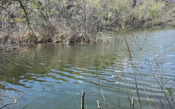
Currently the county is experiencing low land flooding, with numerous reports of individual residences being threatened by high water levels and river bank erosion, but no one has reported actual flooding of their residence, according to Miller. Four homes near Wolf Creek and one on the Lost River in the Methow are surrounded by water and are cut off, he said.
“They’ve all been there before,” said Miller. “Sheriff’s deputies and local police were responding to calls by residents of houses in danger and water over roadways to make sure that no lives were endangered.”
The emergency coordinator said that the potential for flooding from the Methow River at Pateros had been lessened by the release of water from Wells Dam.
Miller said his focus was shifting from the Methow to the Similkameen River at Oroville and the Okanogan River at Tonasket. He said he had spoken with city officials in Oroville and Tonasket about the possibility of flooding.
“There are only four or five houses along the Similkameen and they are high enough that they should be okay,” he said.
Miller said the National Weather Service has projected that the two rivers will have crested above flood stage by Wednesday or Thursday of this week.
Last weekend’s high temperatures began melting the mountain snowpack in Canada sending water rushing down the Similkameen River. Miller described the water expected to come down the Similkameen as a “bulge” that will first hit Nighthawk, travel down to Oroville, join with the Okanogan and then flow onward to Tonasket.
“Nighthawk, Oroville, Tonasket Malott, it is kind of working its way down,” said Miller.
The Similkameen River near Nighthawk has a flood stage of 11 feet, while the Okanogan River near Tonasket has a flood stage of 15 feet. According to the USGS Real-Time Water Data Chart at http://waterdata.usgs.gov/nwis/uv?12442500 the Similkameen measured at the station near Nighthawk at 6 a.m. last Tuesday morning was a foot and a half above flood stage. Water levels at the time appeared to be dropping slightly. At the same time, according to the USGS site at http://waterdata.usgs.gov/nwis/uv?12445000 the Okanogan near Tonasket was at 14 feet, a foot below flood stage at 6 a.m.. The Okanogan River is expected to crest at 16 feet — one foot above flood stage.
“The primary factor has been the snow water runoff into the Okanogan drainage,” said Miller. “Rain is not expected to be a factor according to the National Weather Service and cooler temperatures should help slow things down.”
In the Methow, the Washington Department of Fish and Wildlife authorized an emergency permit for repairs to the river bank in the Lost River Area due to residences being threatened.