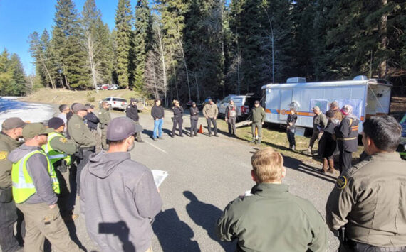
 Photo by Gary DeVon
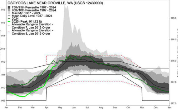
Water levels in Lake Osoyoos climbed as high as 913.50feet above sea level last week, but dropped slightly after a weekend of cool” title=”1925a” width=”” height=”” class=”size-FULL”>
Photo by Gary DeVon
Water levels in Lake Osoyoos climbed as high as 913.50feet above sea level last week, but dropped slightly after a weekend of cool
&#160; &#160;”Significant snow levels remain in the mountains in BritishColumbia. As that snow melts, it feeds the drainages that flow into the UnitedStates and it also fills the lakes in the Okanagan River system in Canada,”states the latest release from Ecology.&#160;&#160;&#160;&#160;&#160;
&#160;&#160;&#160;&#160;&#160;&#160; The need to maintain storage room in Lake Okanagan inBritish Columbia requires that the water managers there continue to flow largeamounts of water down the river. At this time of year, as has happened in thepast, the Similkameen influences the flows in the Okanogan River below the townof Oroville. If the Similkameen flows very high, as it is doing this year, itcan actually flow north for a time, literally flowing back past Zosel Dam andinto Lake Osoyoos, according to Ecology. &#160;&#160;&#160;&#160;&#160; As Lake Osoyoos spans the border, Washington State officialsare monitoring the situation carefully in cooperation with Canadian officials.The gates on Zosel Dam on the Okanogan River near Oroville are operated byEcology and are completely open. However, the dam has no control over levels inLake Osoyoos at this time due to high flows in the Similkameen River, accordingto the state agency.
“How high the lake will rise is afunction of weather. Continuing cool weather with limited precipitation cankeep the lake from rising. However, it is not unusual for the lake to reach 913feet above sea level or greater at this time of year,” states the press releasefrom Ecology.
Although lake levels had beenrising, reaching 913.50 feet as of last Friday evening, on Tuesday morning thelevel had dropped to 913.31 feet. In 1972, the last major flood in the regionit got as high as 917.50 feet, according to Rod Noel, Oroville Superintendentof Public Works. In 1997, the lake level was 915.35 feet at its highest.
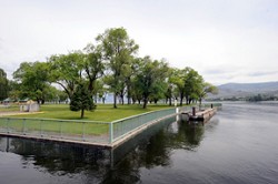
“The lower temperatures we havebeen having allowed a lot of the water to run out,” said Noel. “It’s lookingreally good, I think everything will be fine… we’ve had tons of water get outof here.” Noel said one of the lowest lying areas the cityhas to worry about is Lake Osoyoos Veterans Memorial Park. He said the waterlevels had climbed quite a ways up the concrete near the boat launch, but hadstarted to drop back down.” The National Weather Service ispredicting the temperatures will remain low into next week,” said Noel. “If itremains that way we may get through this just fine this year.”
To allow people to more easilymonitor the levels in Lake Osoyoos Ecology has posted a new website at The SimilkameenRiver, which was measured near Nighthawk at 11.1 feet last week, had dropped to10 feet early this week. The Okanogan River continued to be above the 15-footflood stage, with the level measured at 15.20 feet earlier this week. The riveris down nearly a foot from levels measured the previous Friday at the gage nearthe Janis Bridge south of Tonasket. Some low-lying areas continue to seeflooding between Tonasket and Oroville. Instantaneous measurements at the USGSgage for river near Tonasket can be found at the website: