COLVILLE – The lightning-caused Crater Creek Fire, which began in British Columbia 11 miles southwest of Keremeos on July 22, has progressed south into the U.S. where it is an estimated 8,000 acres.
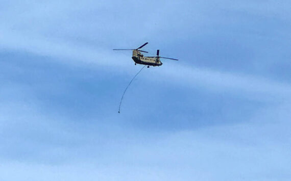
A Type 3 Incident Management Team assumed command of the fire at 6 a.m. on Sunday, Aug 20. The fire which is burning in remote and rugged terrain with poor access, is not currently threatening critical infrastructure or municipal watershed integrity, according to the U.S. Forest Service.
A confine/contain suppression strategy is being implemented, including improving old dozer line and fuel breaks from past fires. Fire behavior varies greatly, due to the almost 5,000 feet of elevation difference the fire is burning in. Fuels are patchy but provide the potential for torching and large runs.
Firefighter and public safety are the highest priorities. Please check up to date road closure information on the websites below. Communication with British Columbia fire officials is ongoing.
Weather: Smoke and haze will remain over the fire area on Sunday and Monday. Winds in the fire area will be mainly terrain driven, except for prevailing southeast winds on ridge tops Sunday afternoon and Sunday night, speeds of 2-10 mph. Very dry air will remain over the fire area on Sunday including poor overnight humidity recovery for most of the fire area especially mid and upper slopes. Max temperature is 67 degrees and minimum RH is 17 percent.
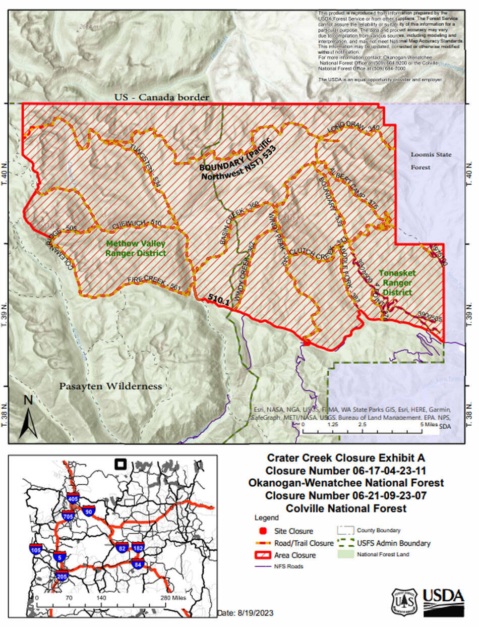
Closures: Closure Orders have been issued by the U.S. Forest Service, BLM and DNR.
USFS: Okanogan-Wenatchee National Forest and the Colville National Forest for the following campgrounds, roads and trails:
Developed Campgrounds Closed
Long Swamp Campground, 14 Mile Campground
Roads Closed
FSR 3900100, 110, 105, FSR 3900395, FSR 3900415, FSR 3900500 (Iron Gate), 502, 505, 510, 515
Trails Closed
Trail No. 340 Long Draw, Trail No. 341 Deer Park, Trail No. 342 Windy Peak, Trail No. 343 Clutch Peak, Trail No. 360 Basin Creek, Trail No. 362 Windy Peak, Trail No. 375 Albert Camp, Trail No. 387 Middle Fork, Trail No. 505 Coleman Ridge from junction with Trail No. 561 north to junction with Trail No. 510, Trail No. 510 Chewuch from junction with 510A Cathedral Driveway north to junction with Trail No. 565 Lesamiz, Trail No. 533 Boundary Trail (Pacific Northwest National Scenic Trail) from the junction of the lower Cathedral Lake Trail No. 545 junction east to the Forest Service boundary with the Loomis State Forest, Trail No. 533.2 Smith Lake, Trail No. 534 Tungsten Creek, Trail No. 561 Fire Creek
https://www.fs.usda.gov/alerts/colville/alerts-notices or https://www.fs.usda.gov/alerts/okawen/alerts-notices
WA DNR: The Washington State Department of Natural Resources has closed the northern block of the Loomis NRCA. This closure includes the Disappointment Trailhead, as well as Cold Springs Campground, Cold Springs Overlook, and Chopaka Lake Campground. The Cold Springs Road is closed 6 miles past the intersection with Toats Coulee Road, and the Fourteen Mile Road is closed 1 mile past the intersection with Toats Coulee Road. https://www.dnr.wa.gov/LoomisLoupLoup
BLM: The Chopaka Lake Campground is closed until further notice.