February daily mountain rainfall records shattered

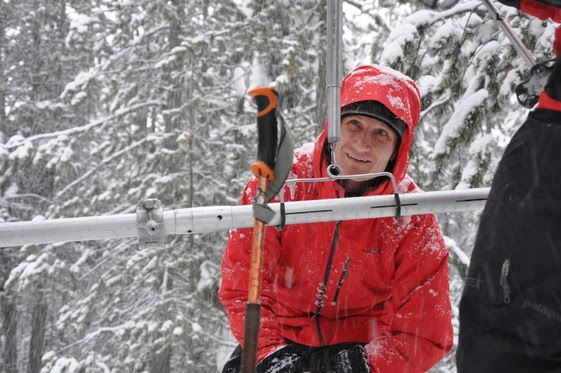
NRCS snow surveyors measure snow moisture content.
SPOKANE – Washington went from one of the driest months in January to one of the wettest in February, according to USDA’s Natural Resources Conservation Service. Daily mountain rainfall records were shattered at many SNOTEL sites in early February.
“From once was the start of another dismal snow year the precipitation and cool temperatures, last month brought a bounty of fresh snow rebuilding an eroded pack back to near or above normal in all basins in the state,” said NRCS Water Supply Specialist, Scott Pattee.
Forecasts for spring and summer runoff have increased by 10-20 percentage points.
At about 85 percent of the way through the season the most recent short term forecast (30-day) has a strong probability for below normal temperatures and above normal precipitation.
“More mountain snow is what we need to at least maintain where we are now and carry us into the growing season,” said Pattee.
NWS 3-month outlook is for above normal precipitation but has uncertainty of temperature. http://www.cpc.ncep.noaa.gov/
Washington State received much above normal precipitation for February and thus far in March with year to date averages remaining near to slightly above normal. The highest percent of average rain fall in February came from the Olympic and Lower Snake basins at 208 percent and 204 percent. The lowest was in the Upper Columbia at 122 percent. Year to date averages range from 138 percent in the Olympics to 94 percent in the Upper Yakima. As usual the wettest area in the state was around Mt. St. Helens with Swift Creek SNOTEL recording 35.1 inches, nearly 22 inches more than the 30-year average or 262 percent of average.
Seasonal reservoir levels in Washington can vary greatly due to specific watershed management practices required in preparation for irrigation season, fisheries management, power generation, municipal demands and flood control. March 1 Reservoir storage in the Yakima Basin was 375,000-acre feet, 83 percent of average for the Upper Reaches and 163,000-acre feet or 120 percent of average for Rimrock and Bumping Lakes. The power generation reservoirs included the following: Coeur d’Alene Lake, 202,000 acre feet, 152 percent of average and 85 percent of capacity; and the Skagit River reservoirs at 56 percent of average and 33 percent of capacity. Recent climate impacts and management procedures may affect these numbers on a daily or weekly basis.
With excellent precipitation and snowfall in February streamflow forecasts have made significant rebounds in many basins from last month. April-September forecasts for some Western Washington streams include the Cedar River near Cedar Falls, 95 percent; White River, 107 percent; and Skagit River, 90 percent. Some Eastern Washington streams include the Yakima River near Parker 97 percent, Wenatchee River at Pashastin 88 percent; and Spokane River near Post Falls 92 percent. Volumetric forecasts are developed using current, historic and average snowpack, precipitation and streamflow data collected and coordinated by organizations cooperating with NRCS. Caution should be used when using early season forecasts for critical water resource management decisions since governing conditions are likely to change for the better or the worse.
Since 1939, NRCS has conducted snow surveys and issued regular water supply forecasts. Since the late 1970s, NRCS has been installing, operating and maintaining an extensive, high-elevation automated system called SNOTEL, designed to collect snowpack and related climatic data in the western U.S. and Alaska.
To view the March Snow Survey and Water Supply Forecast for Washington State, go to www.wa.nrcs.usda.gov and click Snow Survey under the “Topics” tab.
r the “Topics” tab.