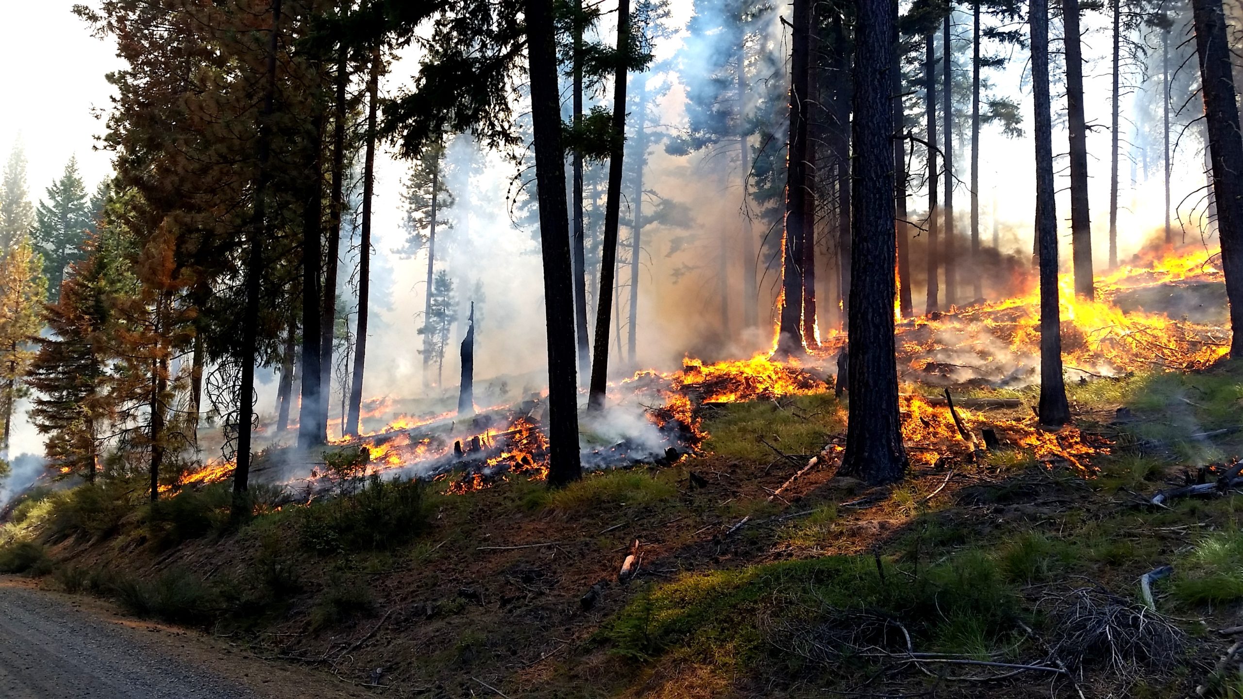

Prescribed fire helps restore the forest and remove unhealthy woody fuel build-up near Naches, WA in 2016.USFS/ Jason Emhoff
Submitted by Holly Krake
Public Affairs Officer, USFS
WENATCHEE — Over the next several weeks, communities along the east slopes of the Cascades may see a different type of smoke column rising above the tree tops; a column that heralds the return of prescribed fire to the land. Excluded from the ecosystem for nearly 100 years, frequent, low-intensity fire is essential for healthy forests and better protected communities.
“Prescribed fire is one of the best tools we have to limit the size and intensity of future wildfires” said Acting Deputy Forest Supervisor, Al Watson. “After a summer of fires that threatened communities, it can be hard to think of anyway fire is good, but at the right time and the right place, fire is a powerful tool for good.”
While more than 8,000 acres are planned this fall, fewer acres may be completed if conditions are not favorable. Conditions include correct temperature, wind, fuel moisture and ventilation for smoke. When these criteria are met, firefighters implement, monitor, and patrol each burn to ensure it meets forest health and public safety goals including air quality.
“Public and firefighter safety are always our number one concern” added Watson. “Unlike wildfires, we can carefully plan burns to maximize restoration while minimizing smoke impacts and risk.”
Residents and visitors can expect to see and smell some smoke each day during burning operations. For more information on smoke and public health, please visit: wasmoke.blogspot.com
Real-time prescribed fire information, maps, and updates:
- Facebook: facebook.com/OkaWenNF/
- Twitter: twitter.com/OkaWenNF
- Text message updates: text ‘follow OkaWenNF’ to 40404
- Interactive map: tinyurl.com/harqnw8
Fall 2017 priority prescribed fire by Ranger District:
Tonasket Ranger District:
Frosty
Bailey
Mutton
Methow Valley Ranger District:
Goat 813ac 2 miles SE of Mazama, Wash.
Lost Driveway Piles 1260ac 2 miles N of Mazama
Eightmile Bottom 450ac 8 miles N of Winthrop, Wash.
Upper Rendezvous 683ac 8 miles NW of Winthrop
Lucky
Chelan Ranger District:
25 Mile 731ac 18 miles NW of Chelan, Wash.
Bear Mountain 124ac 6 miles W of Chelan
Entiat Ranger District:
Lower Tyee 891ac 3-7 miles NW of Ardenvoir, Wash.
Forest Johnson 145ac 9 miles W of Chelan, Wash.
Roaring Ridge 42ac 4 miles NE of Ardenvoir
Bisping Palmich 159ac 4 miles NE of Ardenvoir
Wenatchee River Ranger District:
Fishpole 370ac 1 mile SW of Fish Lake, Wash.
Natapoc 180ac 1-2 miles W of Plain, Wash.
Chumstick 580ac 6 miles NNE of Leavenworth, Wash.
Cle Elem Ranger District:
Liberty 181ac 15-17 miles NE of Cle Elum, Wash.
Orion 345ac 15 miles NE of Cle Elum
Naches Ranger District:
Angel
Canteen 200ac 30 miles W of Yakima near Mt. Clemans
*Additional prescribed fire acres and pile burns may be conducted if favorable conditions allow.